Drain Maps
Drain Map Updates
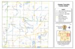
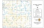
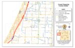
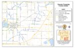
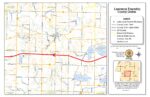
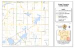
Our drain maps have been updated from old hand-drawn versions to modern digital maps. We partnered with the County Land Services Department and GIS to achieve this. We use legal descriptions and aerial photography to create accurate digital maps of drains and drainage districts. Each drain is mapped separately, and township maps are updated accordingly. These maps are also available as a digital layer in the Pictometry program, ensuring precise data for maintenance and assessments. This in-house process improves accuracy, oversight, and saves taxpayer money. Over 500 drains and districts have been mapped and certified.
You can find updates on drains and county mapping on the county website under Digital Information Department, Digital Maps & Data.